OBSERVATÓRIO VULCANOLÓGICO E GEOTÉRMICO DOS AÇORES
O OVGA é um Centro de Ciência que desenvolve atividade de investigação aplicada e de divulgação científica na área da Vulcanologia, da Sismologia e da Geotermia.

Notícia -A A +A
A Kilauea Volcano First – Water Pond Found in the Summit Crater - Notícia OVGA A 18-10-2019
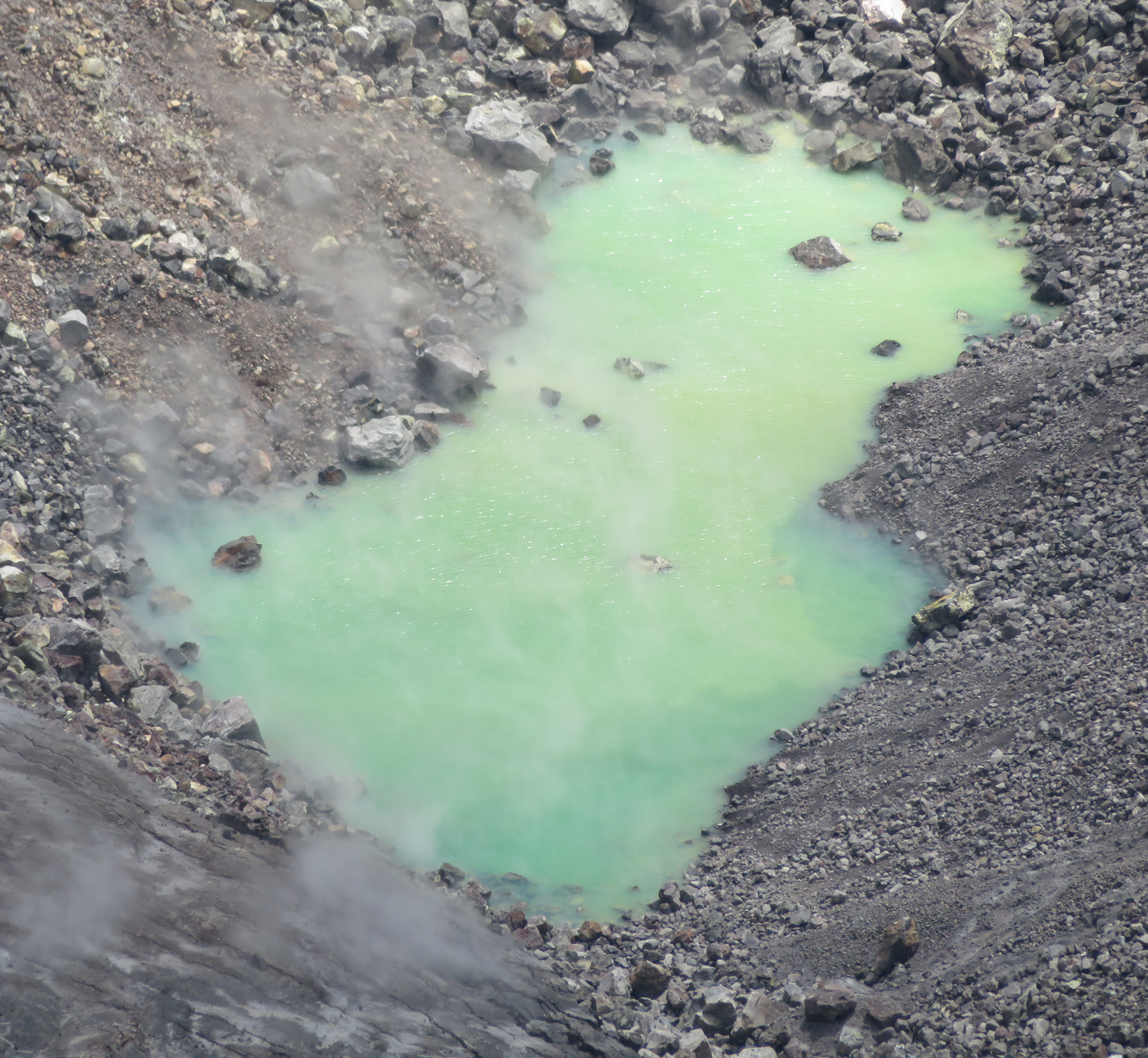
Water pond in Halema‘uma‘u August 18, 2019. The water level continues to slowly rise in Halema‘uma‘u, drowning many of the small rocks that were previously exposed in the center of the pond. Ripples across the water surface were evident today. The color of the water ranged from semi-translucent blue to opaque green-yellow in the western part of the pond.
Credit: Matthew. Patrick, USGS. Public domain
On July 25, 2019, a helicopter pilot flying a U.S.Geological Survey mission over Kīlauea noticed an unusual green patch at the bottom of Halema‘uma‘u, the crater at the summit of the volcano.
Passengers on the helicopter reported to the USGS Hawaiian Volcano Observatory that the smooth green patch looked like water. But with no reflection from its surface, its origin was questioned: was it water, or was it a flat surface made by ash or rockfall dust tinted green by sulfur minerals or algae?
USGS volcanologists generally agreed that if the patch was water, it would be unusual. Water had never been seen in Halema‘uma‘u since written observations of Kīlauea began nearly 200 years ago. The possibility of water in the crater also renewed hazard concerns that arose during the 2018 volcanic events, namely that explosive eruptions can result from the mixing of magma and surface water.
HVO scientists set about seeking answers. In an overflight of Halema‘uma‘u on Aug. 1, they saw reflections from the pond, confirming that the green patch was indeed water. With that question answered, another important one arose: where is the water coming from?
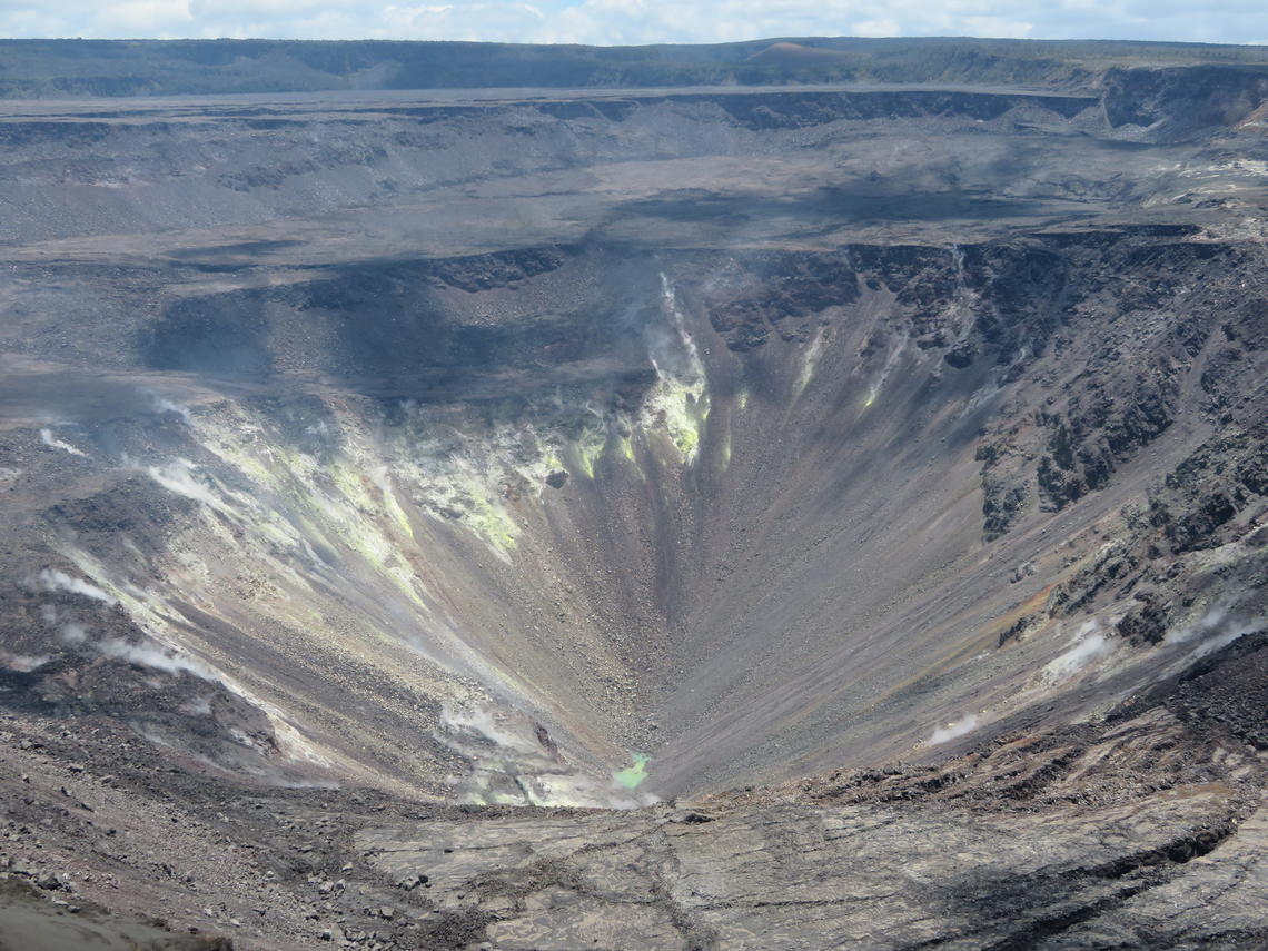
The ponded water at the bottom of Halema‘uma‘u has continued to slowly rise. This wide view shows much of Halema‘uma‘u and the fumaroles on the upper walls of the pit.
Credit: Matthew Patrick, USGS. Public domain
There are two possible sources—rainfall or groundwater. Because the water level has been steadily rising since monitoring of the pond began, groundwater seems the most likely source. Chemical analyses of the water could definitively identify its source but obtaining a sample from the pond is logistically challenging.
It is far too risky for HVO scientists (or any person) to attempt to reach the pond on foot. Not only is the water deep within Halema‘uma‘u, more than 600 meters (about 2,000 feet) below the crater rim, but the crater walls are also steep and prone to rockfalls and rockslides.
Given that limitation, HVO is currently exploring all other options for collecting a water sample, including the use of a helicopter or a USGS Unmanned Aircraft System .
In the meantime, HVO scientists make near-daily visits to the crater rim to monitor and document changes in the pond. Prior to the 2018 volcanic events, when HVO staff occupied offices at the summit of Kīlauea, they kept tabs on Halema‘uma‘u from an observation tower atop the building or from the caldera rim just outside their offices. But the HVO building was badly damaged by earthquakes associated with the 2018 summit collapses and had to be vacated. Today, HVO scientists must first drive from their temporary office space in Hilo to Hawaiʻi Volcanoes National Park, about two hours round-trip, to reach their observation site at Halema‘uma‘u.
From the crater rim, HVO scientists use several kinds of cameras to capture imagery of the water pond. As shown in still photos and videos posted on HVO’s website, the pond is milky green in color, likely due to dissolved sulfur and metals from magmatic gases or dust from the surrounding rock mixing with the water. At times, views through a telephoto lens show that the pond surface appears agitated. The bubbles and ripples could be due to escaping gases rising through the water from below, the water being hot enough to boil, or perhaps, a combination of the two.
Since it is not possible to directly measure the water’s temperature, a thermal camera is used to estimate how hot the pond is. Recent thermal images show that the water surface temperature is about 70 degrees Celsius (160 degrees Fahrenheit), much hotter than the surrounding rocky debris on the crater floor. This information is key to helping scientists understand the pond’s presence.
HVO scientists use a handheld laser rangefinder to measure the water level in the pond, which continues to slowly and steadily rise. On July 25, only one pond was observed in Halema‘uma‘u. As water rose in the bottom of the crater, a second pond appeared on Aug. 3, and a third one was visible on Aug. 4. Since then, the water has risen at an estimated rate of about 1 meter (3 feet) per week, and all three ponds have merged into one elongate pool of water. As of Aug. 22, this single pond was roughly 70 meters (230 feet) long and 30 meters (98 feet) wide, and still growing.
The water in the Halema‘uma‘u pond was estimated to be about 3‒5 meters (10‒16 feet) deep as of Aug. 21. But this depth is likely just the top of a saturated zone that could extend meters or tens of meters (hundreds of feet) deeper. In other words, the pond surface could be the top of the water table.
The pond depth and extent of the saturated zone beneath the crater have important implications concerning potential hazards at the summit of Kīlauea. If magma rises through a thin layer of water, the water would have little effect on an eruption. But with more water, the outcome depends on how quickly magma rises through and mixes with the water and in what proportions. One part magma to three parts water can lead to very violent explosions because there is enough thermal energy in the 1150°C magma to flash vaporize the water and fragment the magma simultaneously.
Slow-rising magma would likely evaporate the water and simply erupt as a lava flow at the surface. However, if magma rises rapidly through a thick layer of water, the magma-water interaction could result in an explosive eruption, although under the current conditions it probably would not be powerful enough to pose a significant threat to public safety.
This potential hazard is why HVO scientists are using all the tools and techniques in their monitoring network to watch for changes within Kīlauea—looking for any sign that magma is moving toward the surface—in addition to tracking the water pond. The good news is that, although magma is slowly returning to the summit at present, Kīlauea monitoring data show no indication of an impending eruption, and it could be years before magma makes its way to the surface.
As HVO continues to closely monitor the pond of water in Halema‘uma‘u at the summit of Kīlauea, new data and significant changes on the volcano will be reported through the HVO website and USGS social media.The water pond is not visible from publicly accessible overlooks in Hawaiʻi Volcanoes National Park, but HVO has deployed a webcam on the rim of Halema‘uma‘u in the closed section of the park. Images from this temporary camera are not high resolution, but they are adequate for tracking large-scale changes in the pond.
Video - https://www.youtube.com/watch?v=WLpBMa1576I&t=166s
Fonte: USGS (26-08-2019)
Adenda OVGA:
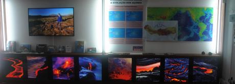
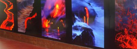
Na exposição do OVGA existem diversos exemplares de lavas e de areias costeiras do Kilauea, recolhidas das diversas expedições ao Kilauea (V.H.Forjaz).
Localização do Kilauea (Hawaii, EUA)